This Map shows you, how far people have to go to the next infrastructure like schools, hospitals, banks etc. It might be a useful tool for overlanders as well.

https://maps.ox.ac.uk/explorer/#/explorer

This Map shows you, how far people have to go to the next infrastructure like schools, hospitals, banks etc. It might be a useful tool for overlanders as well.
https://maps.ox.ac.uk/explorer/#/explorer
Roland was sitting at his desk when I came up. ” We should write something about the marriage”, he said. I was […]
Für die Navigation gerade hier in Marokko und Afrika nutze ich die App OsmAnd die auf die Daten der openstreetmap Karte zugreift. […]
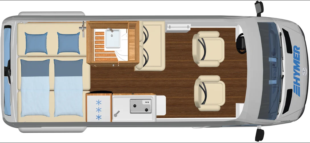
Fortsetzung von Teil I Nach nochmaligem Besuch der Hausmesse bei Hymer in Bad Waldsee ist es nun ein Grand Canyon S (CGS) […]
„Unverpackt Läden“ sind Mode in Deutschland. Ein Gegentrend für eine, vom Ziel her sinnvolle Erfindung, die allerdings mittlerweile maßlos überzogen wird. Verpackung […]


